|
Stick with
me through the beginning. Pictures get better.
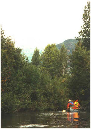
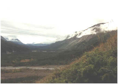
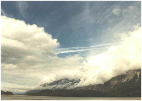
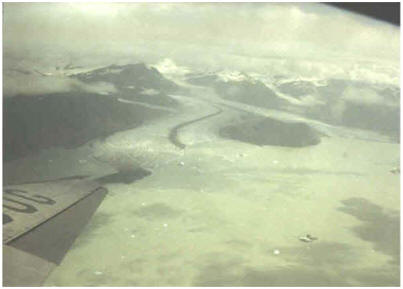
This was
just a side excursion up a small tributary about mid trip.
Could be a creak anywhere USA. |
 |
|
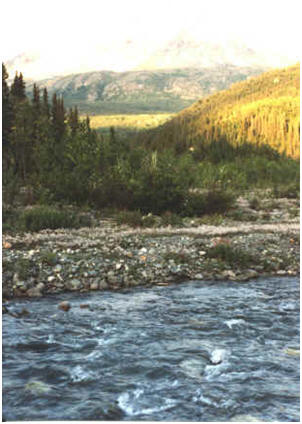
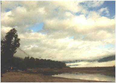
After taking (great) pictures
during our entire first paddling day, a full day of
whitewater and the heaviest of the trip, it was good to be
at a tranquil campsite deep in "god's country" when I
discovered the camera had no film in it. (View across
the river from our campsite) |
 |
|
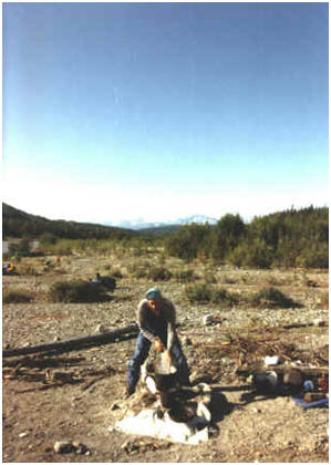
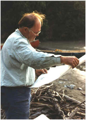
Yours truly make breakfast for
the group, second morning on river. The white patch on the ground is a fire
blanket to prevent unsightly campfire residue which
otherwise would remain visible for a long time (leave it the
way you found it policy). |
 |
|
Caught this immature eagle
while cruising by on our fast moving river. Just think, all
you have to do is keep your camera dry, your mind on
approaching river hazards, get the camera out of and back to
it's water tight box while not missing the photo op. |
 |
|
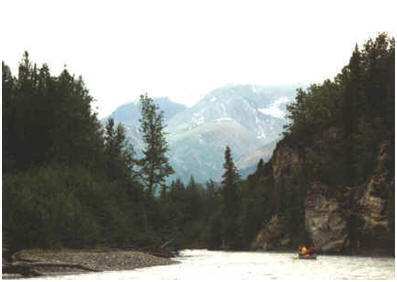
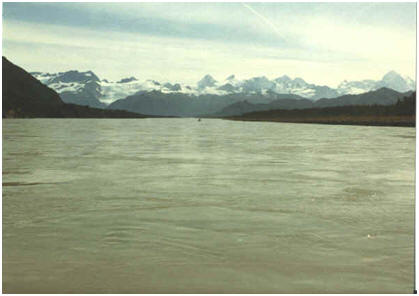
A little
about the river. The Tatshenshini River trip starts at
Dalton Post, Yukon, Canada, passes through British Colombia and ends near the coast on the southern tip of
Alaska.
The
dense, tall vegetation is about to change.
The Tat is a
glacier fed river. It's extremely cold and carries an opaque silt created by
an ice-flow grinding rocks against rock
creating a fine gray powder. Suspended in the water, it's so
thick you can't see an object 1/4 inch below the surface. |
 |
|
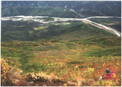
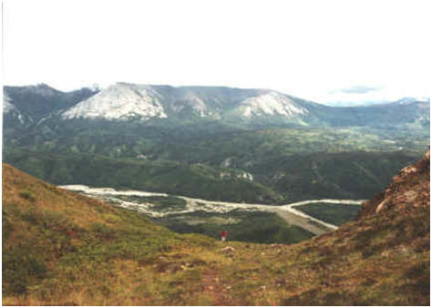
We've just taken a short hike
up a hill (900-ft vertical) to see miles of the valley we
will follow downriver. The stream in the immediate foreground is a tributary. |
 |
|
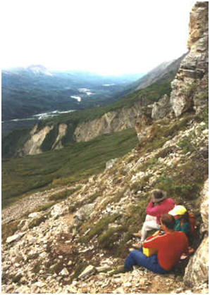
There are no hiking trails
here. We're sitting on a rare, known game trail even if you
can't make it out in the photo. It's about 1,500 feet above
the river. The trail keeps climbing. There's only one way
out of here for people, it's the river in the distance. |
 |
|
Maybe we'll
just climb 2,000 feet vertically.
It doesn't
look like it from this camera location, but downstream river
direction is to the upper right. |
 |
|
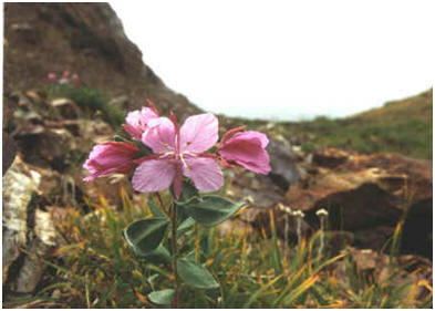
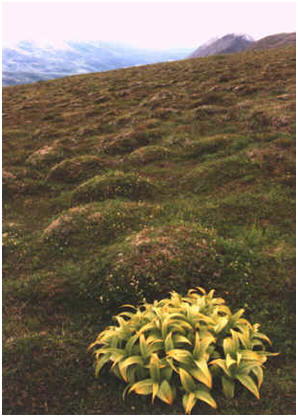
We're about 2,500 feet above
the river and looking skyward. Even on this harsh windblown
slope an occasional small full blossom. Taken within inches
via close-up lens, you're likely seeing it larger that the
original plant. |
 |
|
 |
|
This is tundra, a carpet of
small plants surviving atop a carpet of former small plants.
Winter and wind level any vegetation that stands "up". Where
did this one broadleaf come from? There are no others within
site or down the mountainside. |
 |
|
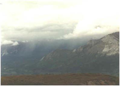
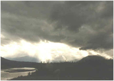
At 3,000 vertical feet above
the river, the notion of being prepared is reinforced by the
view of a rainstorm back upriver. We started out to get a
view from atop a 900-foot hill 2,100 feet below. |
 |
|
 |
|
George is just double-checking where we
are. Reading topographic maps against an enclosed terrain is
as much knowing where you have been immediately before as it
is reading the surrounding topography. |
 |
|
Morning. Time to get up and
paddle. |
 |
|
It may be chilly, but we might
be able to eat, get tents down and gear packed before it
rains. |
 |
|
 |
|
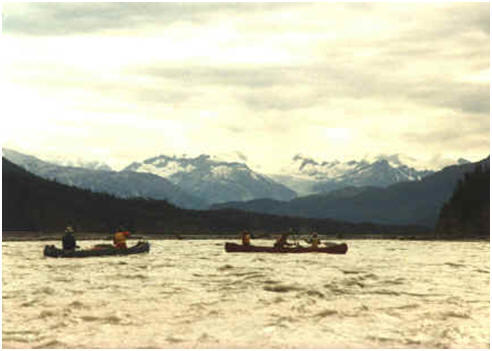
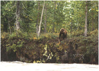
This grizzly had only one thing
on its mind. It wasn't us whizzing by pushed by a fast
moving current at around 8 mph. His
question was "Do I feel lucky?" The river had spread out to
at least 1/4 mile wide. |
 |
|
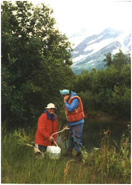
Another daily group chore. Find
and filter the group's water supply. With the Tat's silt, we
stop at side streams. The filter pump will remove anything
organic down to 2 microns. Metals and the like are another
subject and usually not a worry in this kind of environment.
The river was just saved by the Canadian government. A
mining company wanted to level one of the mountains. Where
was the mining company going to put all the tailings;
according to the company "without harming the
environment"? |
 |
|
 |
|
 |
|
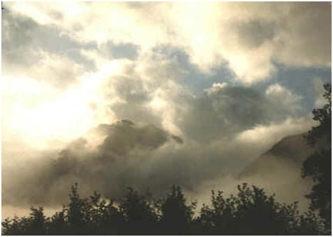
A glorious sight to wake up to! |
 |
|
 |
|
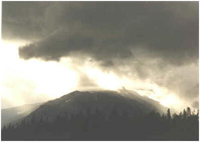
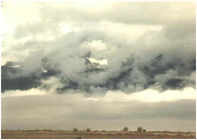
The dark layer is not deep blue
sky, it’s mountain. |
 |
|
 |
|
 |
|
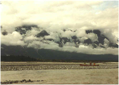
There's a landslide stretching
across the base of this "small" glacier. |
 |
|
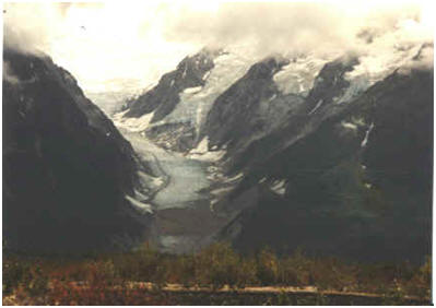
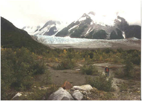
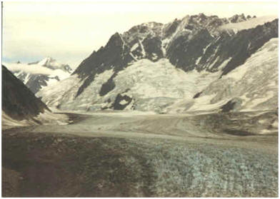
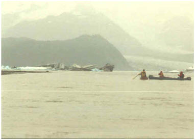
Perhaps 2 miles off from
this vantage point,
it will be the first glacier we can touch.
The photo below may be around
the 1 mile mark. |
 |
|
 |
|
 |
|
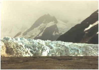
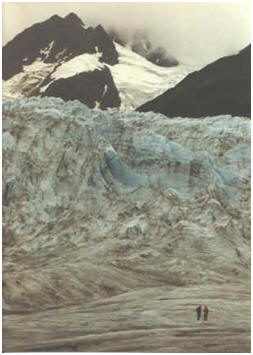
Look close, you may spot the
person at the top of the brown surface, extreme right?
 |
|
That brown surface we started
out on now shows itself to be carrying human size boulders
and is just part of the glacier complete with waterfall
cutting down through the center of the ice sheet. There must
be an under ice river. We never figured out where the
outflow was. |
 |
|
 |
|
 |
|
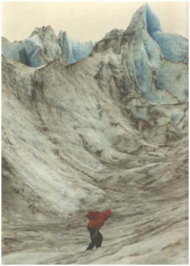
Winter parkers and mittens.
It's considerably colder standing on the glacier than
standing near the cold river.
End of trail without
ropes and pitons. |
 |
|
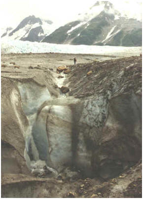
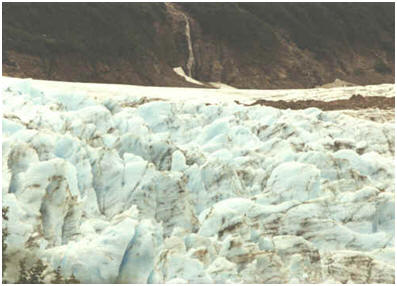
Glacier fed waterfall dead
center far side. Hue patch of earth in glacial transport
shows why the dark surface down below. We've climbed with
difficulty up the mountain for a view from above. Can't see
up the glacier yet. More climbing to go if we are not
prevented by the landscape. |
 |
|
Why are these people laughing?
Can you set up a camera on a rock, click the shutter, run
and get balanced on some tiny boulders to be visible in the
picture, all without knocking someone off there spot before
the camera timer goes off? (Curt's not that tall.) |
 |
|
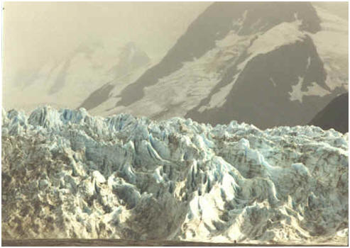
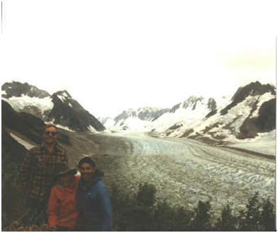
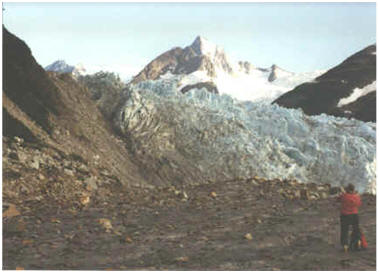
A 300 millimeter telephoto view
up the glacier shows it has miles to go beyond sight. |
 |
|
This is a composite of five
photographs; an approximate 200 degree view (2/3 of a circle) 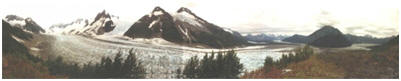 |
|
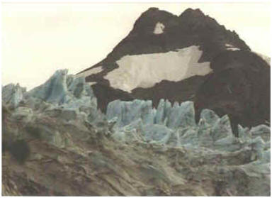
20-ft high ice spikes (two
stories) crown the
glacier's edge. |
 |
|
Goodbye glacier, on to river
adventures. |
 |
|
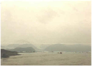
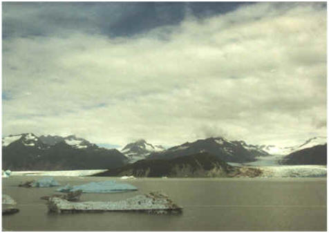
Moving fast on a wide river,
something’s strange in the distance. (Make note of the large
darkened mound left of center, and low level white snow patches
center and right.) |
 |
|
We're entering a lake. The
mound is a mountain, the white snow icebergs. |
 |
|
Though not raining there is
dense moisture in this cold air. |
 |
|
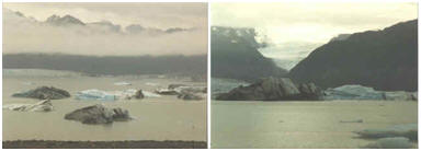
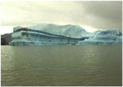
Think of 4 to 5 story
buildings. Now consider their width. As freshwater icebergs,
90% is underwater. These are trapped in the lake until they
melt small enough to flush down river some Spring thaw. It
will take years. The water temperature is 34 degrees.
(Check out "big blue" in both photos.) |
 |
|
 |
|
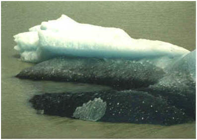
Just a small burg left, about
25 feet exposed, rolled over on its side. |
 |
|
 |
|
 |
|
 |
|
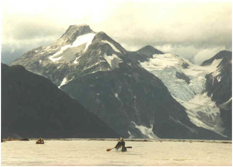
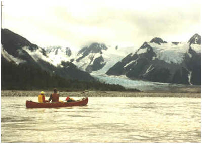
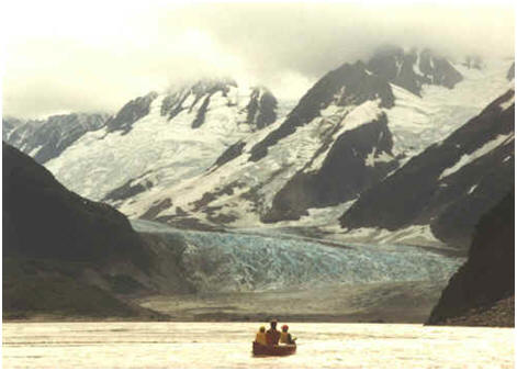
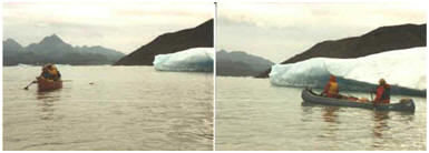
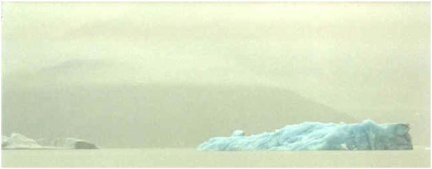
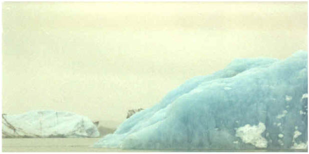
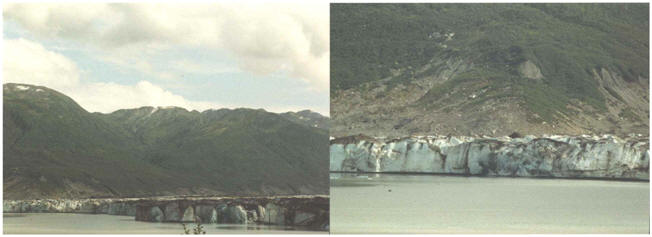
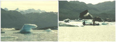
With
glaciers on two sides of a lake 2 x 3 miles across, this
place is about size not easy to convey. See anything in the
water first photo? Look at the second photo (300 millimeter
telephoto). See the minute (speck) dark object in the water left
side? Now look at the left photo again. I had to search to find the canoe in
real life knowing they had to be out there. See it near
the shadow on the water?
 |
|
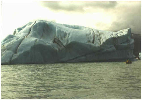
Big Blue |
|
 |
|
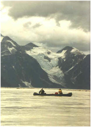
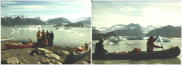
We're leaving the lake and
headed toward the takeout.
 |
|
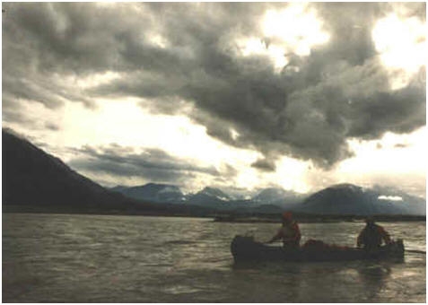
Looking back up-river, a glacier
is still visible high in the far distant mountains; the lake
is well
beyond sight. Center is a fast moving canoe, mostly from river
current.
 |
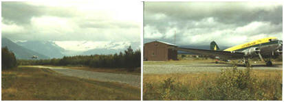
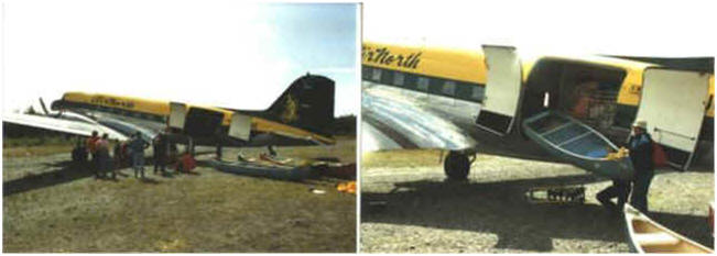
|
It's a salmon industry gravel
runway with no support for landings and no scheduled flights
such as the one landing in the first photo. The building is locked. There's no other way out
accept paddling via the ocean. It was good to see our
charter show up on time the morning after we took off the
river.
 |
|
 |
|
A view of the lake from the air
and only one of the two glaciers. Remember that "mound"?
It's center right. |
 |